Mawlersĺ Big Adventure ĺ04:
Dawson City to Border City
Tuesday, 10 August 2004
|
||||||
|
From this part of the trip on out, we have no plans. I know, you can hardly say we had plans up to this point, but from here out, we do not even have hotel reservations. Our basic plan is to drive (you could have guessed that) out of Dawson City and into Alaska, staying at a place called "Tok" (pronounced like "smoke"), then through the Yukon and to Haines, take the ferry to Skagway, back up to the Alaska Highway and then basically back to Edmonton and home.
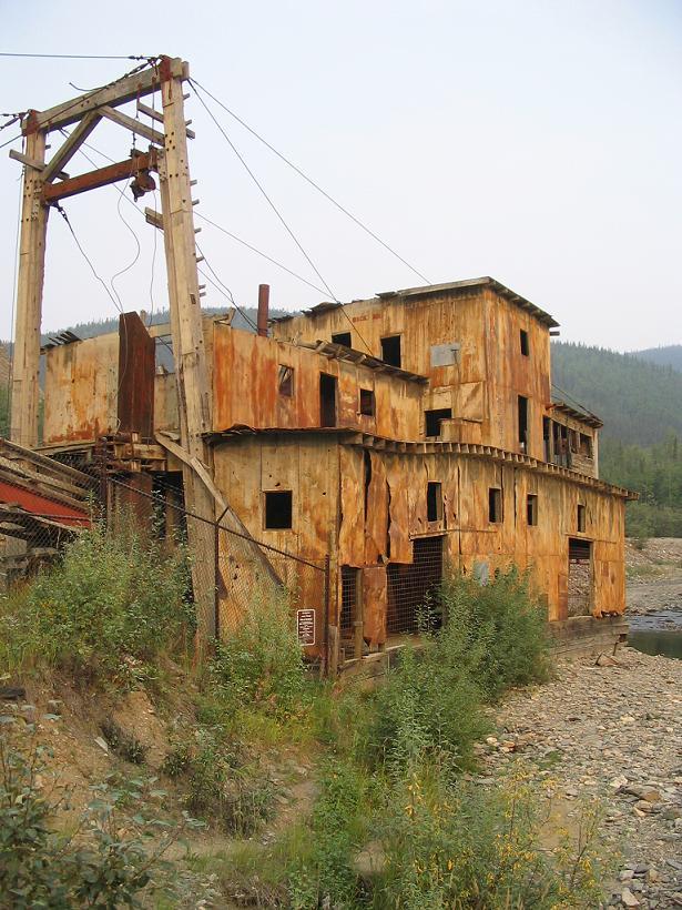
First, however, I need to finish up my paper. I am on a roll, based on my work the previous night, so we go to the coffee shop down on the waterfront and sit. I have two mochas and manage to finish my paper. The mochas are not decaf. Can you say wired? I should be able to use that to connect to the internet. Despite having finished the paper, we decide to let it sit for a day or so, to make sure it still sounds rational when I have come down off the mochas. Lea Ann has gotten herself a frequent coffee card from the cafÚ, and in two days, we have 9 punches. Is that bad? However, we do go log on and update our travelogue pages a bit, although weĺre slowing down on that front. (Had you noticed?) Lea Ann has one more sight that she wants to hit in Dawson City before we leave ľ the Jack London Interpretive Center. We go over there, and it is a reproduction cabin and bear cache using some of the original logs from Jack Londonĺs original cabin in the Great White North. The interpretive center itself is a series of photos, letters, and other information about Jack London, his time in the Yukon, and the process of collecting the info for the center. The person who has pulled it all together, Dick North, happens to be there running the center, as well. I recognize the name Dick North, and I ask him about the photographs and stories on the walls in the Eagle Plains Hotel, which he acknowledges having written. He goes on to tell us that he went to school at none other than George Washington University and then Berkeley. It gives the interpretive center a different angle to be able to talk to the man who put it all together. So, right on schedule, in the late afternoon, we board the ferry and cross the Yukon River on our way to Alaska for the first time on our trip. The highway on this side of Dawson City is called Top of the World Highway, and it soon becomes apparent why. It is steep, very hilly, and has incredibly deep valleys on either side of the road. However, the views arenĺt as lovely as they could have been because the smoke is getting worse and worse as we drive towards Alaska. As weĺve said before, the forest fires this summer have been pretty bad, basically all around where we are going.
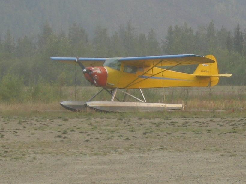
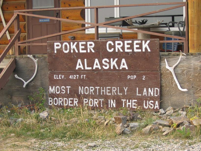
We cross the border at Poker Creek, population 2 (Iĺm assuming that would be the (1) American Border Guard and the (2) Canadian Border Guard.) This is the northernmost border crossing in the U.S. We stop to take pictures at the Alaska sign and then continue on. In our guide book, there is mention of a side trip to a town called Eagle. It is about 80 or 90 km off the highway, and it has a great deal of historical information and activities. But, we agree we canĺt make it this tripů Itĺs just a kilometer too far. However, the guide book mentions that this is an "anus-clenching" road. So, you know we have to try it out. Lea Ann has been driving this day, and she puts some of her gravel road training from high school into action. The road doesnĺt look so bad ľ not really any worse than the other gravel roads weĺve been on, but about 10 km into the road, Lea Ann says, "whatĺs that?" At first I donĺt hear it, but soon the telltale sheeeeewwwwww flup flup flup flup indicates that we have lost another tire. Darn.
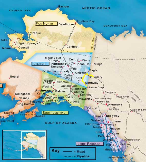
Now, Lea Ann and I have had vast training in the changing tires category, driving such fine DC roads as the BW Parkway on a regular basis, and weĺve considered going out for a pit crew. On the Passat, our record is under 10 minutes from pulling off the road to pulling back on, and thatĺs with a full trunk. So, we get out of the truck and note the time, cockily assuming that our 10 minute record will holdů on a different vehicle, with a different type of jack (too small, if you ask us), on a gravel roadů We get the Jeep jacked up, but weĺre on a hill, and the tiny little toy jack that we were provided doesnĺt want to hold the truck up. Suffice it to say, 45 minutes later, we have managed to get the spare on the truck, and we decide that in this case, discretion is the better part of valor, so we slowly go back to the main road and give up our "anus-clenching" side trip. A little further along, we come to beautiful downtown Chicken, Alaska. This is a tiny "town" of a saloon, a gift shop, and a "restaurant" that was a mining town in the gold rush (was any town not a mining town in the gold rush?). It used to be called Ptarmigan, but the miners couldnĺt spell it, so they changed it to Chicken. We stop and have some maple walnut ice cream (very good), and pet the 3-legged dog that is a fixture here.
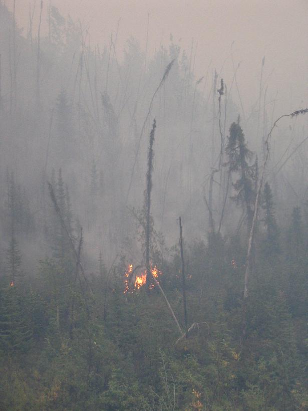
We also stop for gas but find that they are "closed" but theyĺll let us have gas if we have cash. We donĺt often carry cash, anyway, but on vacation we keep some, especially up here where not everyone has a phone, much less a credit card machine. But, we didnĺt think about the fact that we donĺt have any U.S. currency. Yes, thatĺs right. We have plenty of Canadian cash, but no American money. Whatĺs so funny about that? So, we scrape together $14. It feels a lot like high school. We give it to the woman, whoů no reallyů un-padlocks the gas pumps for us. Shortly after Chicken, we find that the smoke is getting very bad. Even with the car on "re-circ" so we arenĺt taking any air in from outside, weĺre still feeling our eyes burn and our lungs protest, not to mention the less-than-perfect visibility on the road. So, what do we do? We stop to take pictures, of course! The colors of the burnt ground and the orange trees are beautiful, and the smoke makes the sun neat colors. A little further down the road, we actually pass actively burning fires, so we stop to take pictures of that, too. What?
We had originally "planned" to go to Tok for the night, but it turns out that there are some campgrounds in the direction we want to go, so we bypass Tok altogether. The campgrounds sound appealing, but we are concerned about the smoke. The further we go, the worse it gets, until, within 10 km of the campground, we start to see trucks parked on the side of the highway. Then, the trucks give way to large, industrial looking fire trucks and firemen on the side of the road, waiting. Somehow, this doesnĺt seem like the place to camp tonight. We keep driving, and we find a motel/gas stop/convenience store/restaurant right on the Alaska/Yukon border. There is a sign on the door that gives a phone number and says to call if you are there for the motel ľ otherwise they are closed. I call them from the phone that is installed on the porch ľ not a payphone, just a phone ľ and they are very gracious and let us check in. We are pretty exhausted at this point, and we fall into bed, just after we notice that the room is very nice. |
||||||
|
|
||||||
 see it on a map |
||||||
|
|
||||||
|
The previous installment: |
The next installment: |
|||||
Back to Great White North Trip main page
Back to Mawler Home
All materials © 2004 Lea Ann Mawler & Stuart Mawler